
 Search
.jpg "Tibetan Local Travel Agency")


Bhutan Maps
Lying on the slopes of majestic eastern Himalayas and bordered by Tibet and India, Bhutan is a magic place where you can find inner peace.
With “High Value, Low Impact” policy, Bhutan never boasts its virgin beauty of forest-flourishing landscapes, untouched mountains, and eco-diversity valleys, rather, they live peacefully and have largely maintained a primitive way of living.
It is this trait that makes Bhutan shrouded with mysteries and attracts increasingly a large number of visitors all over the world to explore.
To ensure you a successful and pleasant tour to Bhutan, we carefully select a number of Bhutan location map, Bhutan border map, Bhutan-India map, and the Bhutan tourist map, etc.
We will keep upgrading the available maps shown below and uploading or mapping more new directly-apprehended maps of Bhutan to provide more Bhutan tourism information.
Bhutan on World Map / Bhutan Map Images / Where is Bhutan located on a map?
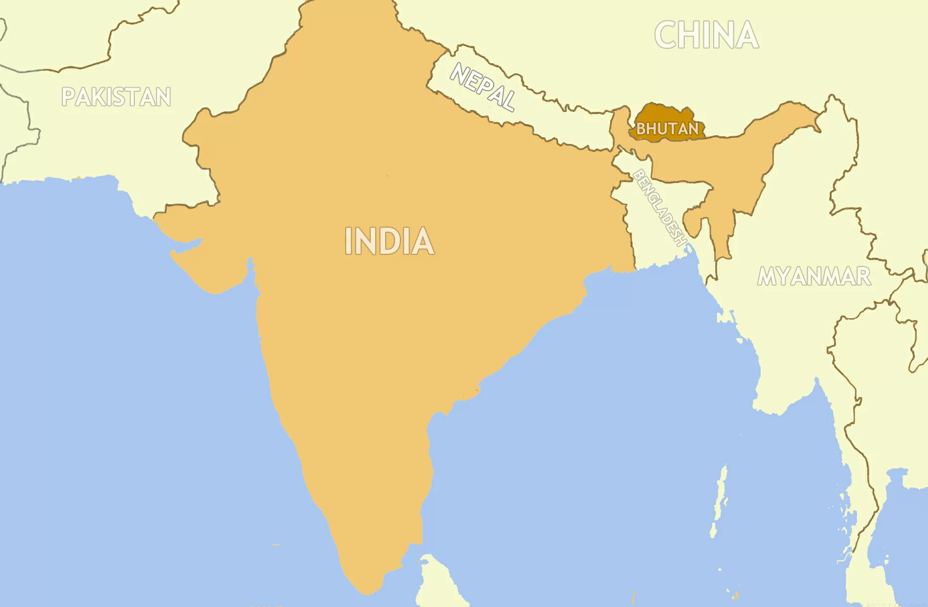
Bhutan is a landlocked country located on the southern slopes of the eastern Himalayas. It is adjacent to Tibet Autonomous Region of China in the north, the Sikkim state of India and the Chumbi Valley in the west, the Arunachal Pradesh state of India in the east, and the state of Assam and West Bengal in the south.
Maps regarding to the location of Bhutan listed below are available for you to better understand the realm of this dragon kingdom.
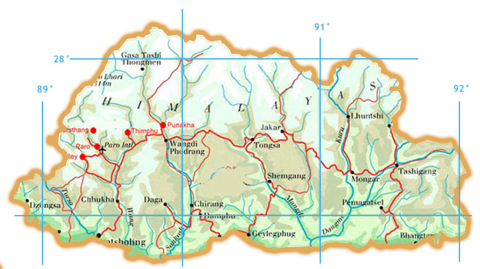
 Bhutan Location on a Map
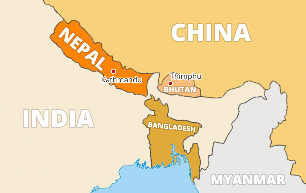 Bhutan Map with Surrounding Countries
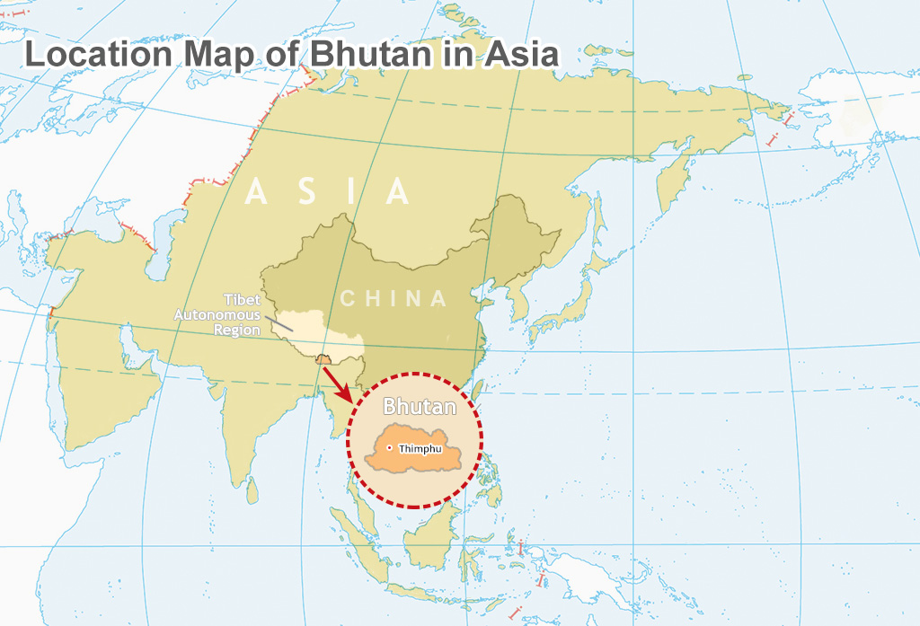 Bhutan Location on Asia Map
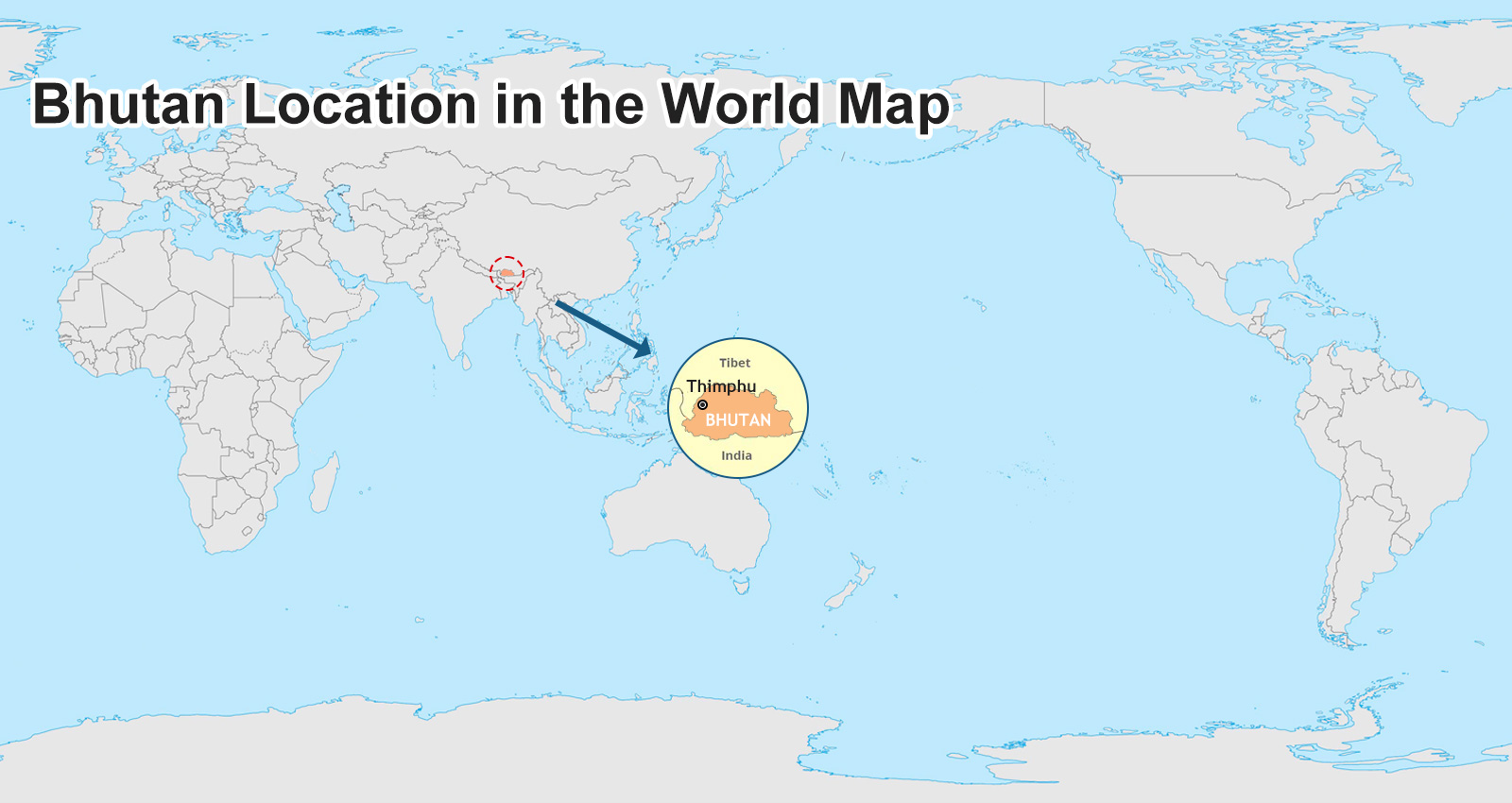 Bhutan Location on World Map
 Bhutan Map on Google Earth
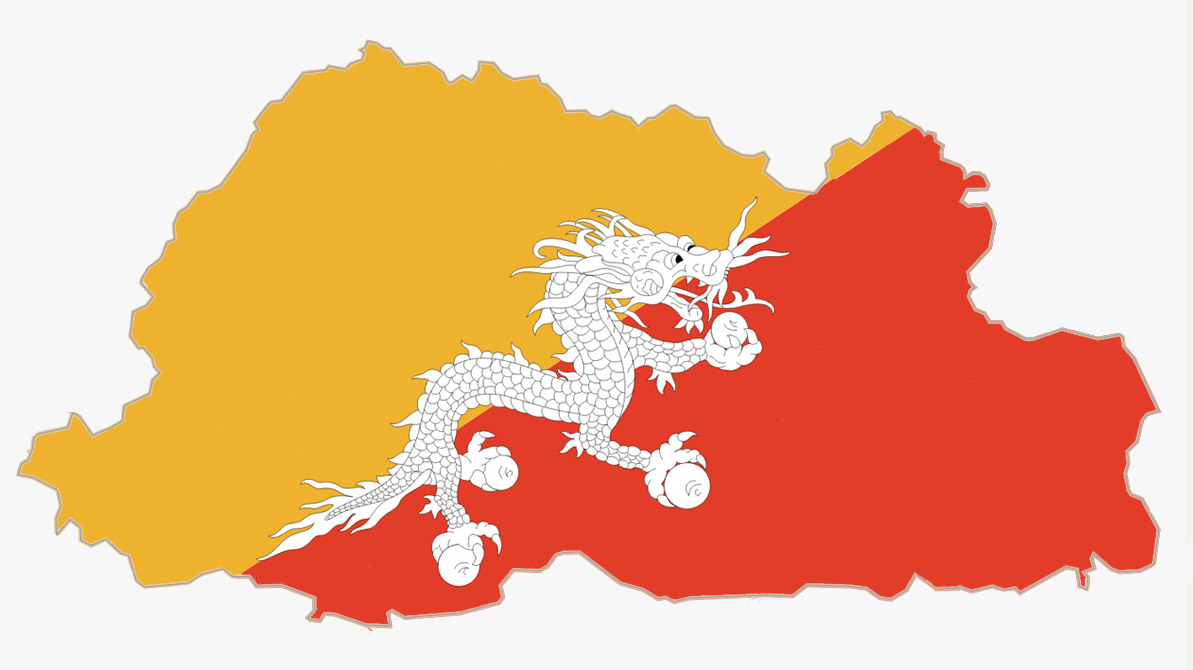 National Flag of Bhutan
Bhutan Political Map
Bhutan is composed of 20 districts (Dzongkhag, singular and plural) and administrated by a body called Dzongkhag Tshogdu.
Population Density is a measure of the degree of population concentration in an area. It serves as the ratio of the total population of a given area to the total land area expressed in square kilometers (km2). In Bhutan, the capital city Thimphu has the highest density of 67.1 persons per km2, followed by Samtse Dzongkhag with the second highest population density of 48 persons per km2.
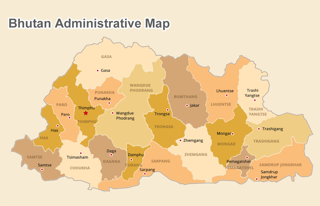 Bhutan Administration Division Map
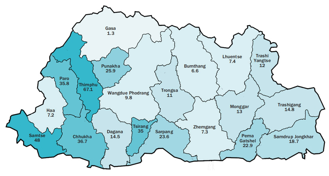 Population Density of Bhutan in 2017
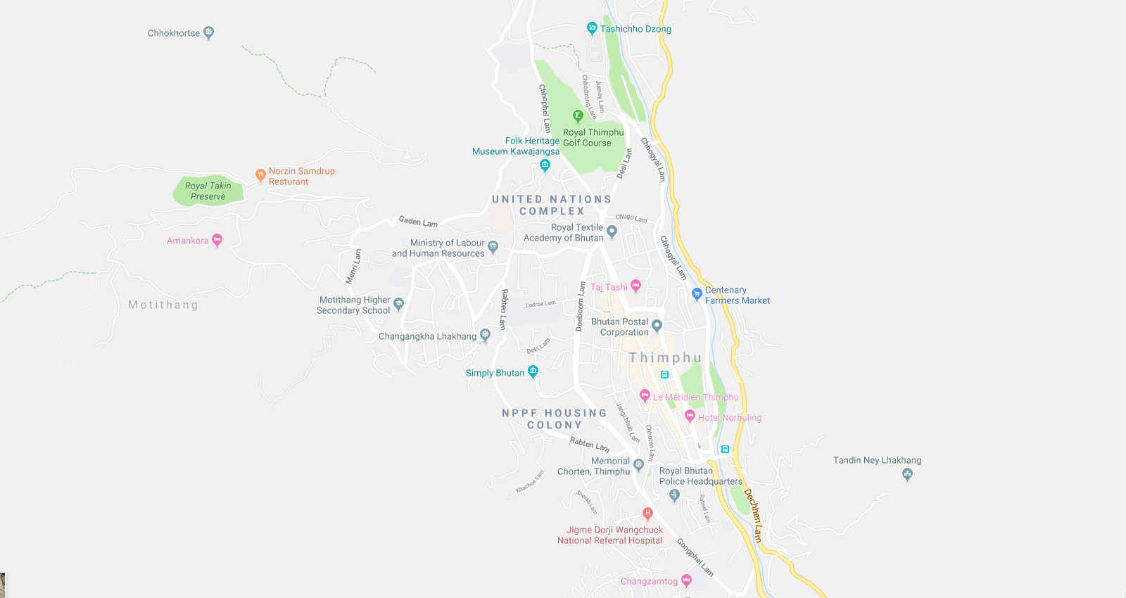 Thimphu Bhutan Map
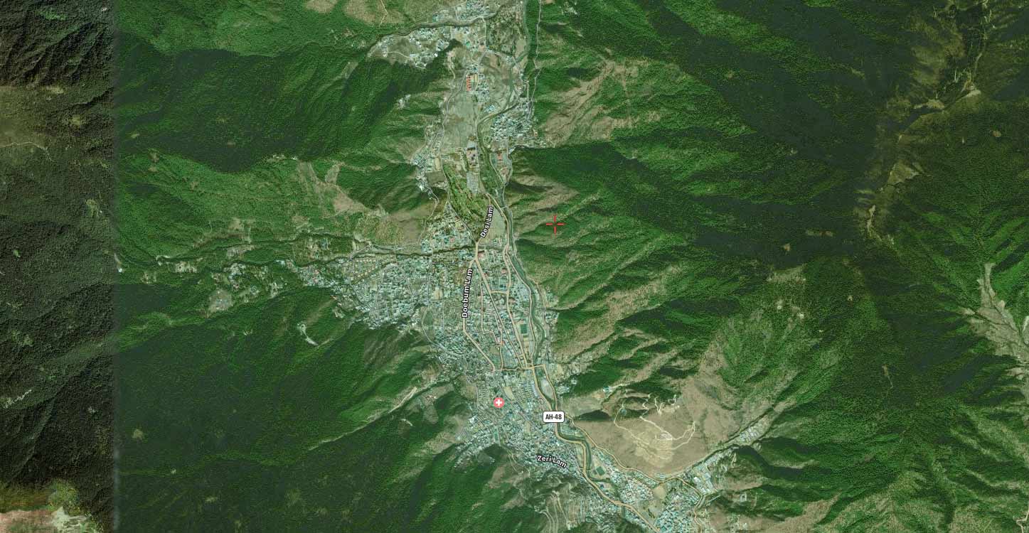 Google Map of Thimphu Bhutan
 Paro Bhutan Map
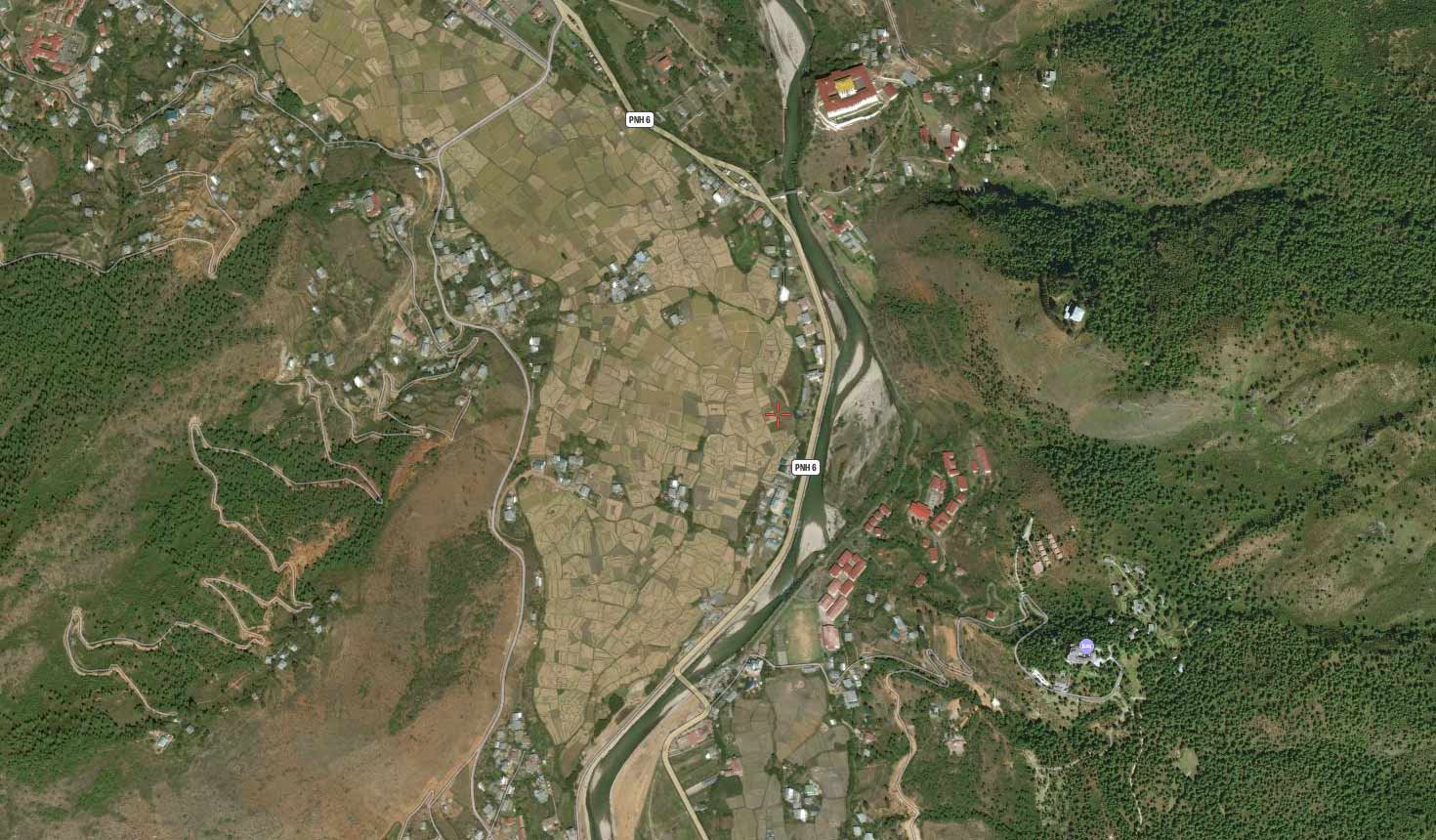 Google Map of Paro Bhutan
Bhutan Travel Map
Want to explore the majestic dezong fortress? Want to dress like a Kira and draw the Bhutan bow on an archery range in lush forest? Want to trek the mountains and breathe the air to get an inner peace? Want to hear the spiritual owl puncturing the night during your trek in gigantic biodiversity valley? Ever fancied trekking above the pristine forests and valleys to get a draw-dropping view of Bhutan Himalayas? What on earth to expect for this amazing tour? Just follow us to unveil the mysteries of Bhutan from the following straightforward Bhutan travel maps.
 Bhutan Geographical Map
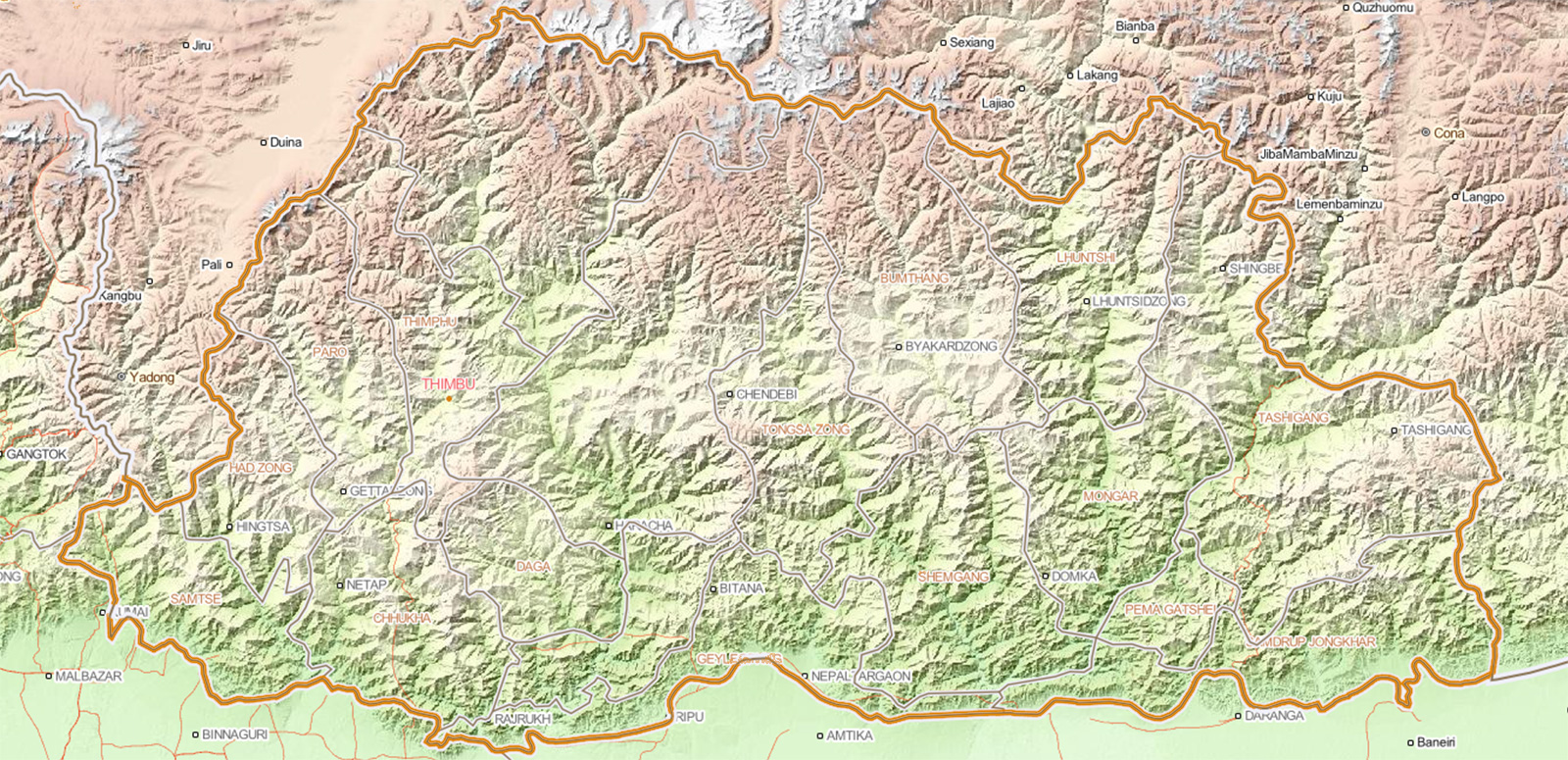 Bhutan Altitude Rising Map
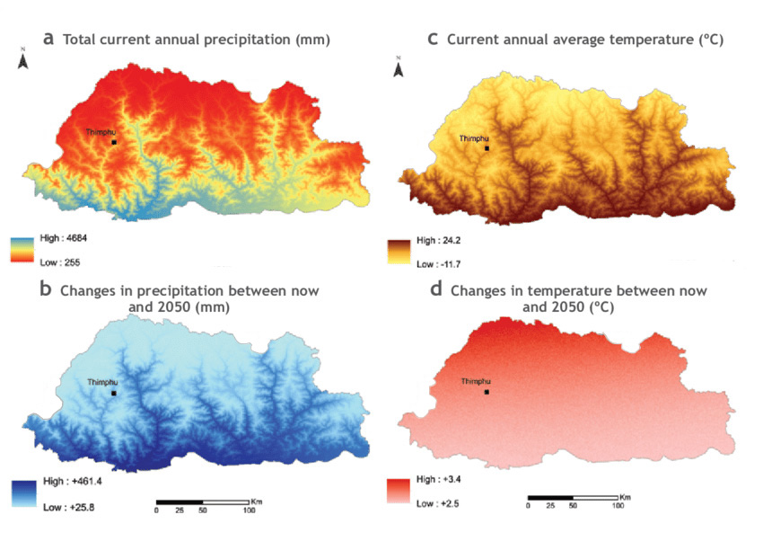 Bhutan Climate Map
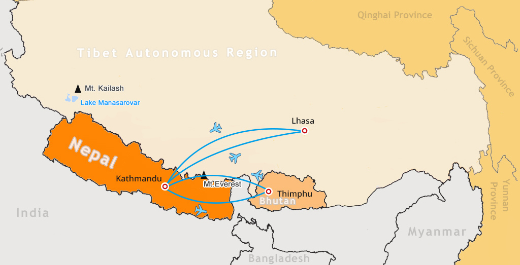 Flight from Lhasa to Thimphu through Kathmandu Map
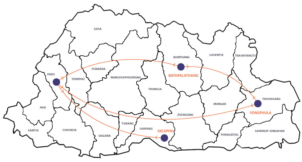 Bhutan Domestic Flight Map
 Bhutan International Airline Map
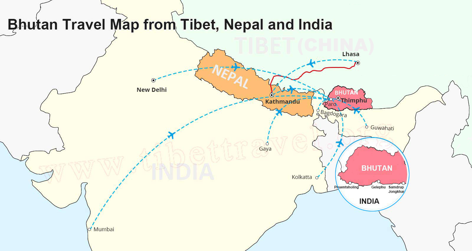 Travel Map of Bhutan, India, Tibet and Nepal
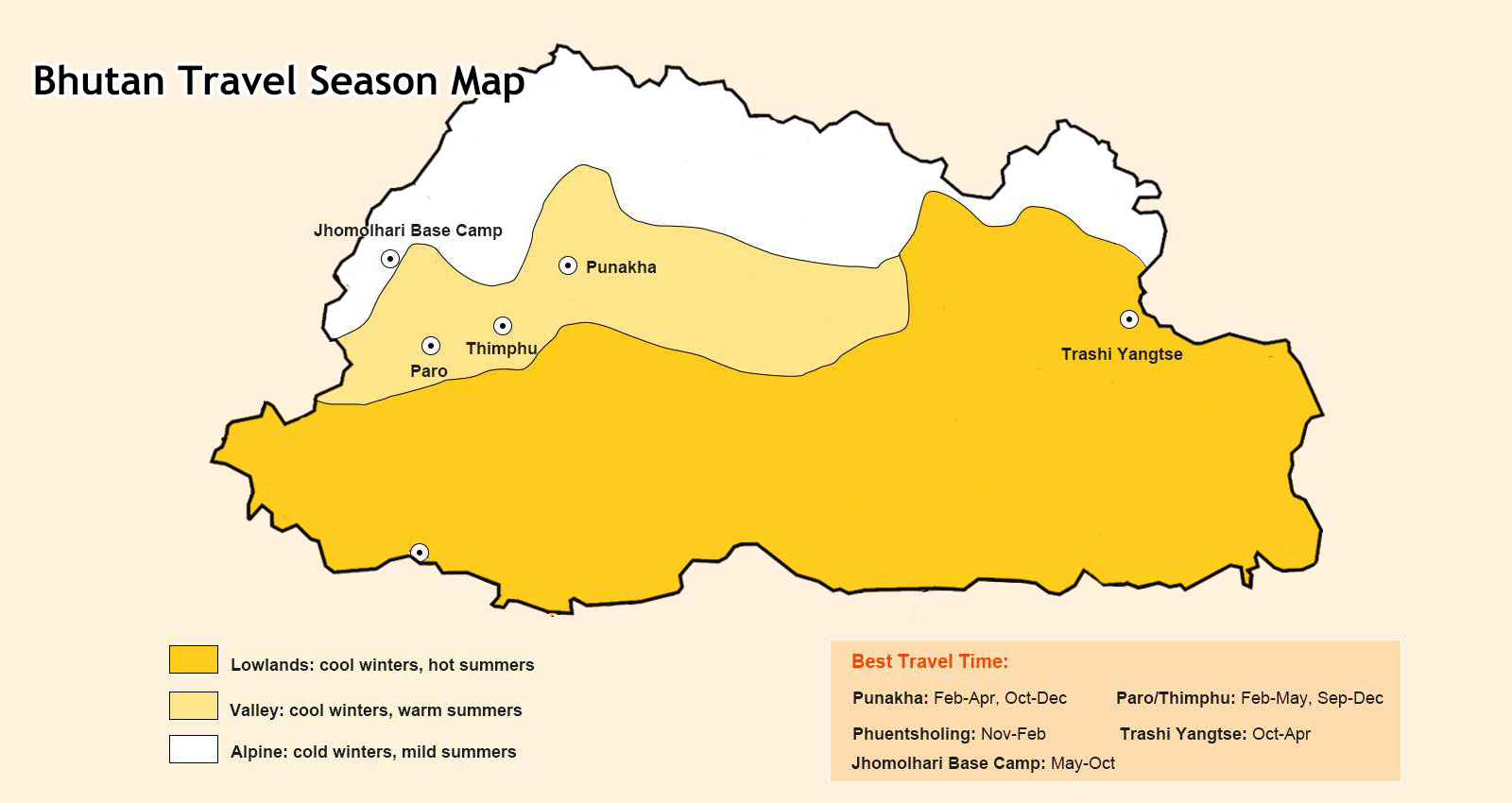 Bhutan Travel Season Map
 Bhutan Tourist Map
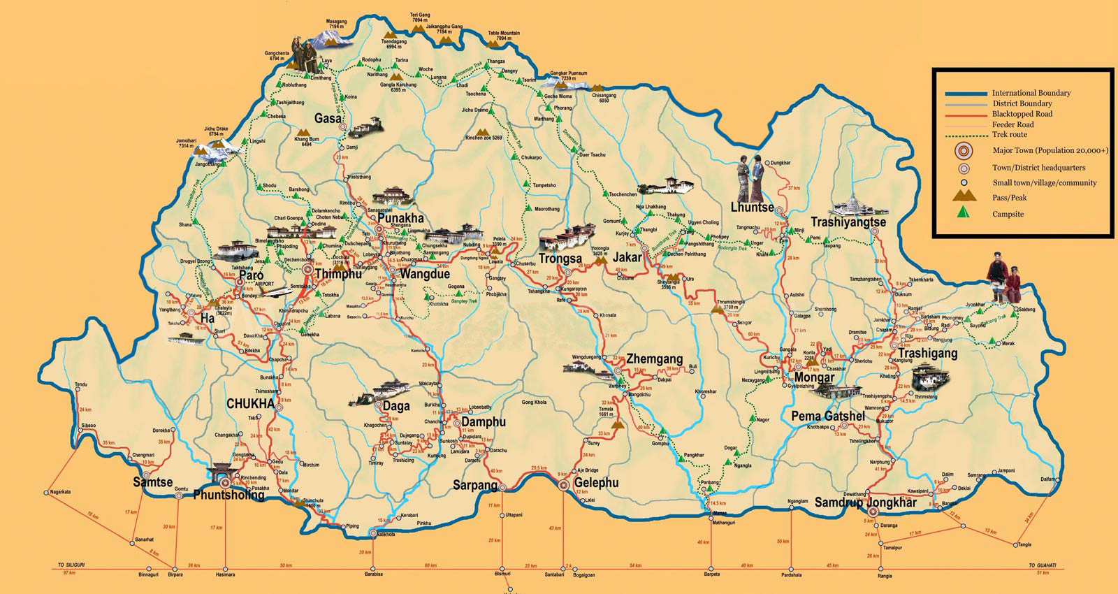 Bhutan Tourist Attractions and Trekking Routes Map
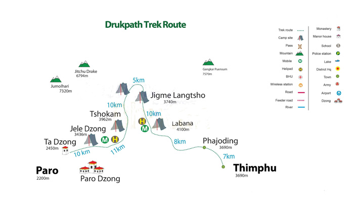 Druk Path Trek Map
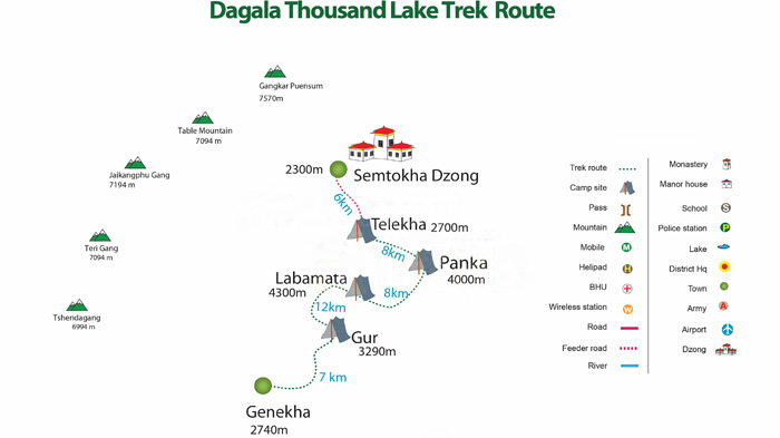 Dagala Thousand Lakes Trek Map
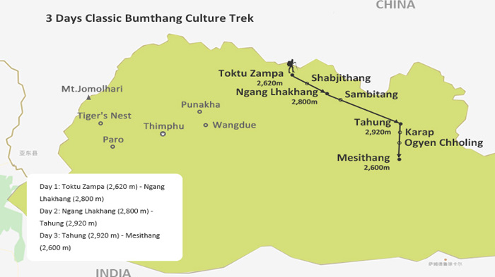 Bumthang Culture Trek Map
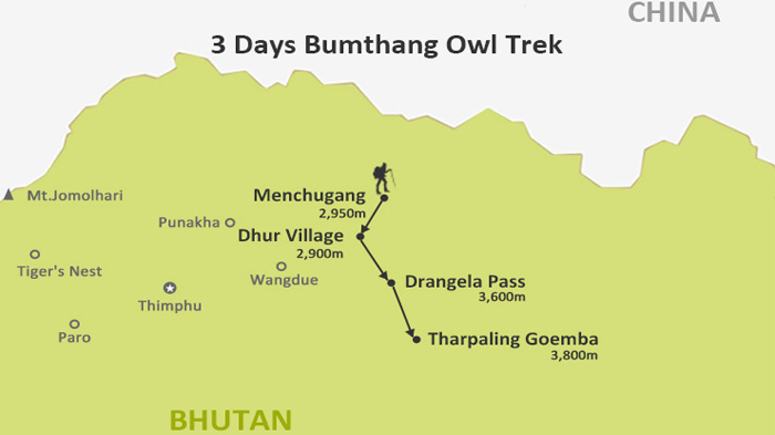 Bumthang Owl Trek Map
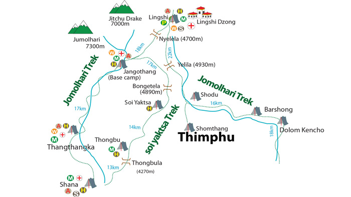 Jomolhari Trek Map
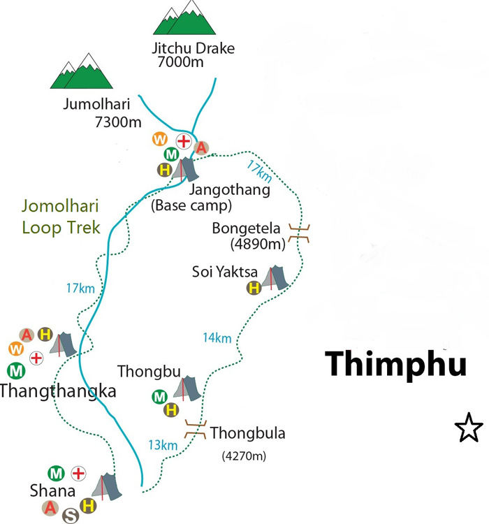 Jomolhari Loop (Soi Yaksa) Trek Map
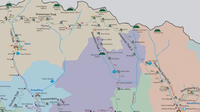 Snowman Trek Map
Bhutan Border Map / Bhutan Map with Surrounding Countries
The kingdom of Bhutan borders Tibet in the north, the Chumbi valley, Doklam Plateau and the Sikkim state of India in the west, the Arunachal Pradesh state of India in the east, and the state of Assam and West Bengal in the south.
Normally, the Bhutan kingdom is supposed to have frequent communications with its border countries. However, with a strong ancient culture and environment preservation policy, the Kingdom of Bhutan had almost completely cut off for centuries to avoid foreign influences.
Bhutan began to open up very slowly to outsiders in the 1970s. Although tourism was privatized by the Bhutan Royal Government in 1991, there still have strict restrictions. Travel is only possible on a pre-arranged package or a well-organized tour.
>> Read more about Bhutan Border Map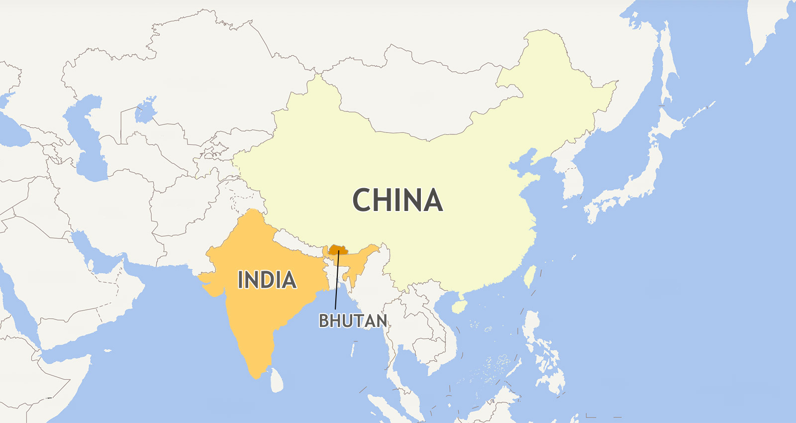 Bhutan China India Map
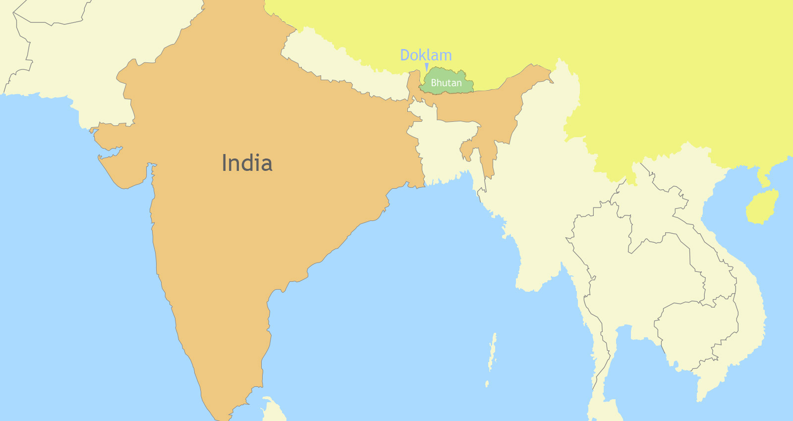 India Bhutan Doklam Map
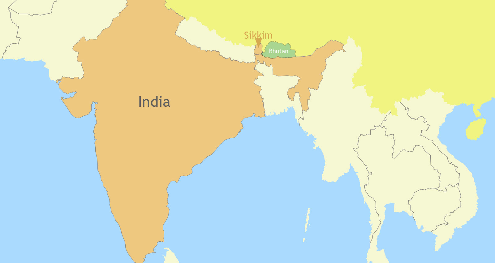 India Sikkim Bhutan Map
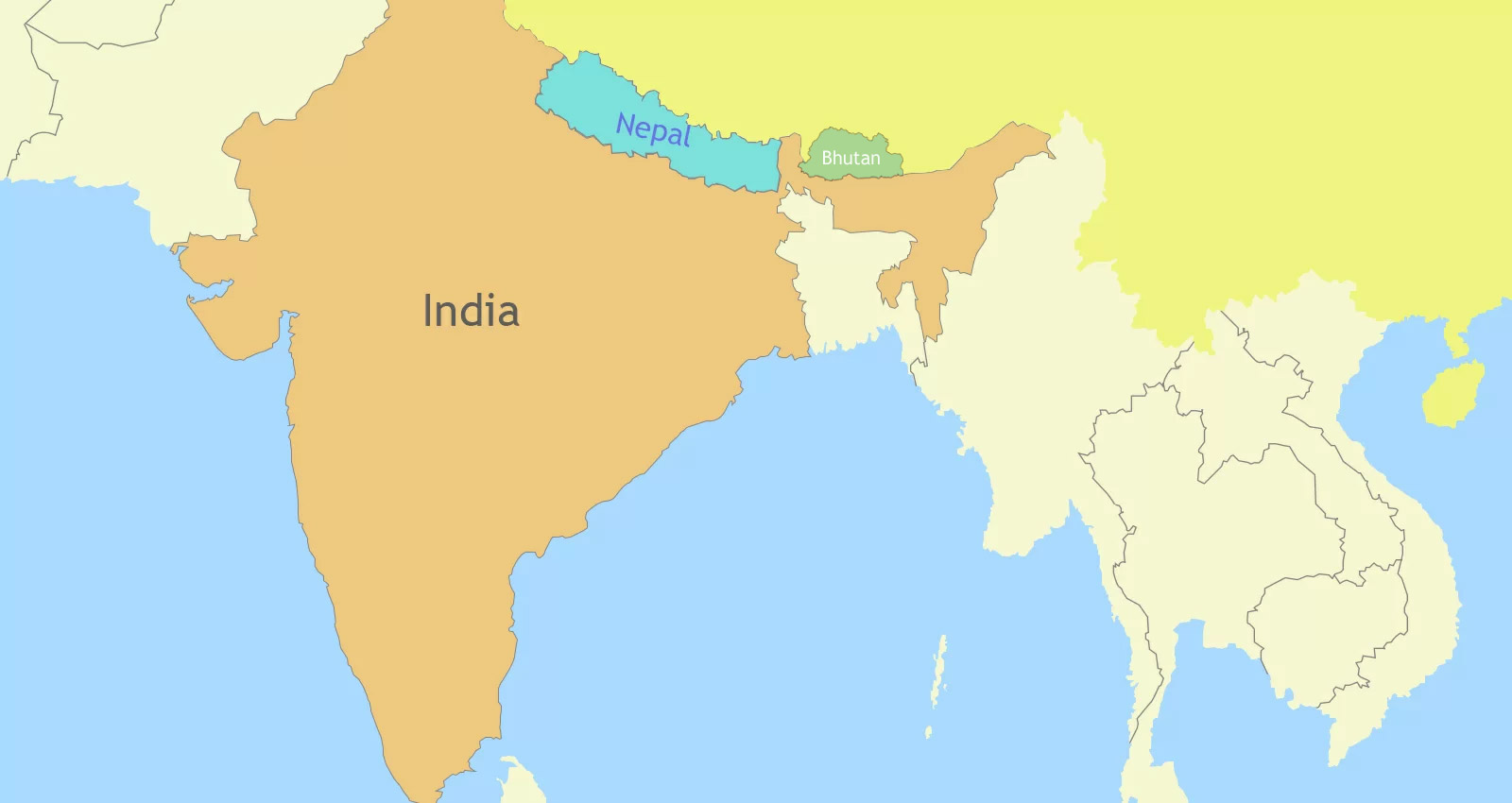 India Nepal and Bhutan Map
Bhutan-India Map
Bhutan - India Border is the international boundary between the Kingdom of Bhutan and the Republic of India. It lies windingly in the southwest, south and southeast of Bhutan. The border is 699 km long and adjoins the Indian states of Sikkim (32 km), West Bengal (183 km), Assam (267 km), and Arunachal Pradesh (217 km) in an anti-clockwise direction.
 Bhutan and India Located on Map
 Bhutan India on Map
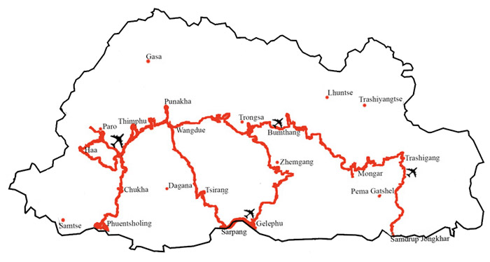 Road to Bhutan on Map
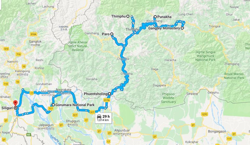 India to Bhutan by Road Map
Bhutan Nepal Maps
The “almost” neighbors of Bhutan and Nepal both lie in the Himalayas, bordering on Tibet to the north, and with just a small section of India separating them. And they do share many similarities in climate and elevation. Both landlocked, these small Himalayan countries may be tiny in relation to the global map, but are huge in terms of tourism and environmentalism.
 Map of Nepal Outline
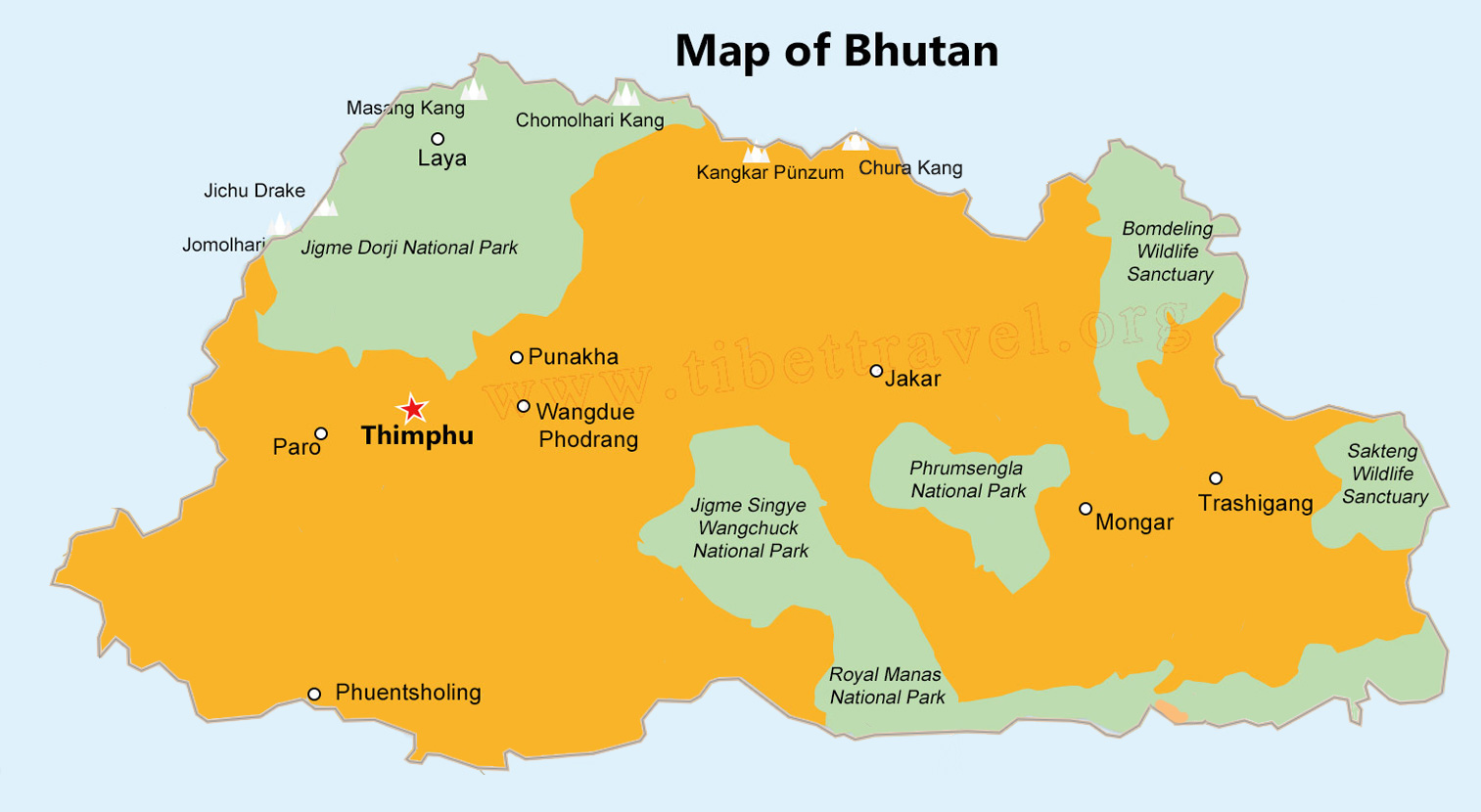 Map of Bhutan Outline
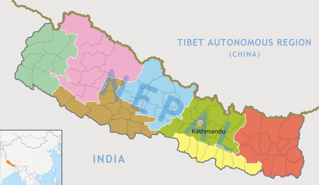 Nepal Seven Provinces Map with All Districts
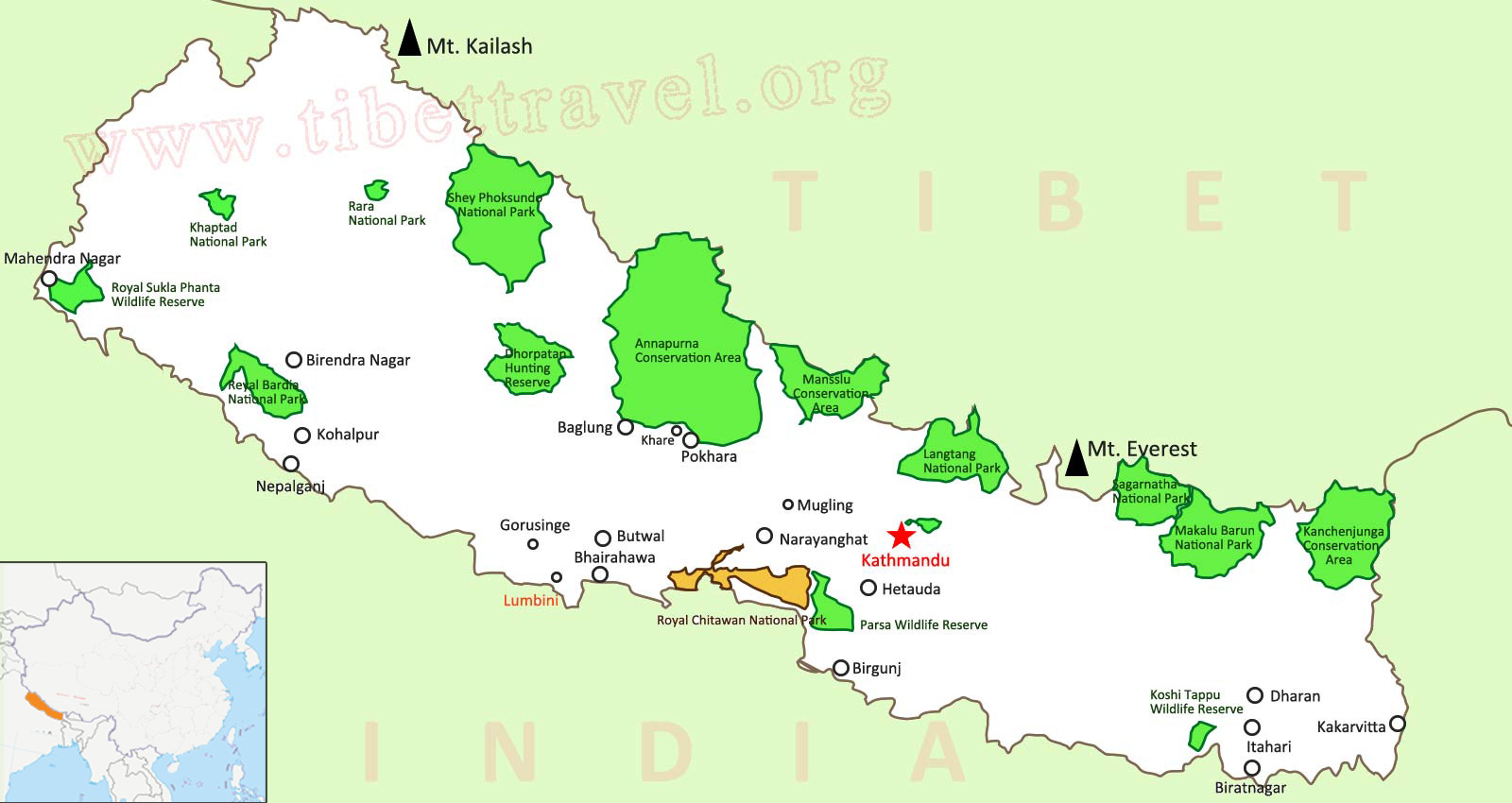
 Map of Nepal Bhutan Tourist Attractions
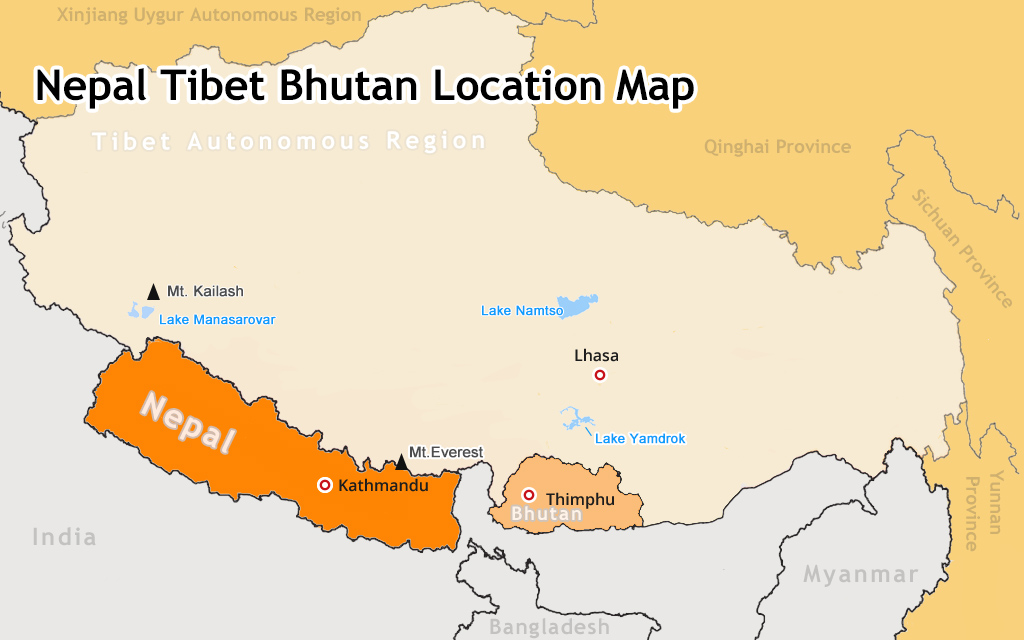
 Nepal Bhutan Map with Surrounding Countries
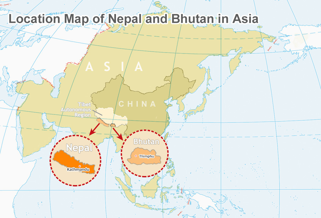 Location of Bhutan & Nepal in Asia Map
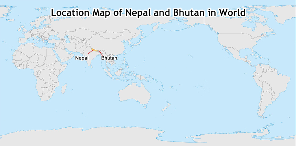 Location of Bhutan & Nepal in World Map
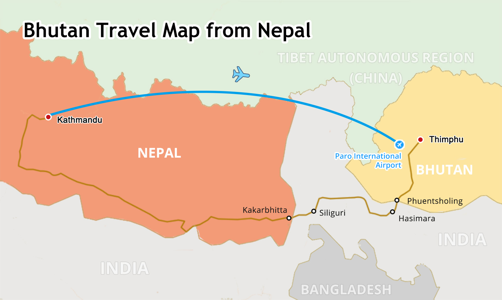 Bhutan Travel Map from Nepal
We will give a timely updating to the available maps and upload more maps relating to Bhutan travel. If you have any map that can be very helpful for you in mind but cannot be found here, feel free to let us know, and we can draw it and share it with you. Your suggestions are more than welcome.
- Bhutan Maps
- Where is Bhutan located on a Map?
- Bhutan Travel Map
- Bhutan Border Map/Bhutan Map with Surrounding Countries
- Where is Bhutan in India Map? / Bhutan India Map
- Ultimate Bhutan and Nepal Tourist Maps
- Map of Tibet and Bhutan
- Your Definitive Maps of Tibet Plateau and Tibet Tourism
- Most Comprehensive Maps of Nepal to Help you Plan a Lifetime Nepal Trip More Easily

"Bhutan Maps"